Stéphane Bruchet
_______________________︎︎︎ back
The cultural landscape
of the Boggeragh Uplands
This project presents a critical meditation on the Boggeragh Uplands landscape. Instead of following a purely documentary framework, the work adopts a contemporary re-imagining of the photographic survey tradition. Through this lens, the project seeks to translate the intricate relationship between people and place into a visual language guided as much by subjective sensibility as by observation.
It is an inquiry into how landscapes hold memory, how communities inscribe meaning onto their surroundings, and how photography can serve as witness and interpreter in this ongoing dialogue.
Description
About the Boggeragh Uplands
Our understanding of landscape is a complex mosaic that combines physical reality, human intervention, administrative boundaries and digital dimensions.
Click on individual headings below for details.
Natural regions are defined by interrelated physical and ecological factors such as topography, climate, and vegetation, which together generate landscapes of relative coherence and continuity. Such regions frequently extend across multiple administrative boundaries, including counties and electoral divisions. In the Irish context, examples include the Burren, the Drumlin Belt, the Golden Vale, and Connemara. Within these regions, landscapes have evolved through lasting processes of human–environment interaction, as communities adapted to environmental constraints while actively modifying their surroundings through the use of local resources. These interactions have produced enduring patterns of land use, cultural identity, and social organisation.
The Boggeragh Uplands represent a distinct and relatively homogeneous landscape unit shaped by sustained human occupation. Archaeological evidence, comprising megalithic artefacts and ringforts, together with historic settlement patterns and modern infrastructure, attests to a continuous process of landscape formation spanning several millennia. Patterns of movement and connectivity within the uplands were structured by routes and pathways closely aligned with the area’s physical morphology, reinforcing internal cohesion. Until the late 20th century, the challenging topography affected interactions with the surrounding lowland valleys.
The NPWS defines the uplands as areas above 150m in altitude.
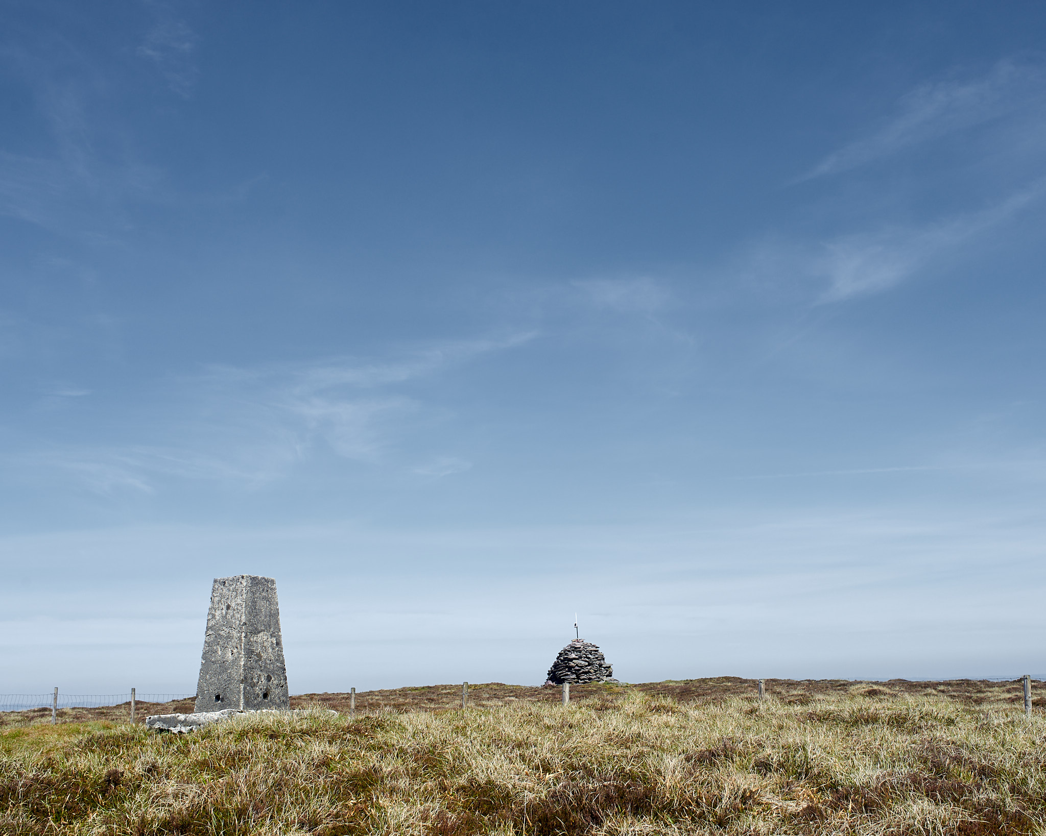
Musheramore (Alt: 643m) dominates a succession of hills and valleys between the Blackwater and Lee rivers. The uplands cover around 200 square kilometres. The elevation drops sharply westwards towards Millstreet (Alt: 134m) and on the Southern slope towards Macroom (Alt: 118m). The North plateau slopes softly before dropping further towards Mallow (Alt: 74m) and the East descent towards Blarney (Alt: 55m) and Cork City is gradual.
The heart of the area above 300m consists mostly of peat blanket bog and grassland, with monoculture forestry and wind farms as alternative economic resources.
Between 300m and 150m, a big part of the marginal land has been reclaimed for agriculture.
A rich network of streams meandre along the slopes to feed the rivers Blackwater, Lee and Feale. Many of them have a dark colour due to the peaty nature of the ground.
A portion of the Boggeragh Uplands is designated as Natural Heritage Area. The site consists of three sub-sites above 300 m. Altogether, they amount to 362 hectares.
The Boggeragh Mountains were considered for inclusion in the Geological Heritage of Cork for their particularly good examples of unusal river channels. The area was surveyed in 2023 but not selected in the final list.
Administrative divisions are the result of political decisions. They facilitate governance and the local provision of services. The division of land by authorities changes over time.
Townlands have no offical function, but are still important for records or planning permission. They were established in the 12th century, with boundaries defined by natural features or land use of the time. This heritage is reflected in their names as Gaeilge. Boola near Bweeng refer to the tradition of booleying or transhumance. Names with Glen, Knock, Tullig or Mona invoke a terrain of mountains and bog. Barrahaurin derives its name from Barr-a’-chaorthainn, the top of the mountain ash while Nadanuller is the Eagle’s nest.
Civil Parishes were used for taxation and census gathering but their administrative functions were largely made obsolete by the end of the 19th century.
Modern adminstrative functions are managed at the County level, which is divided in Electoral Divisions.
The designation of a section of the Boggeragh Uplands as Natural Heritage Area as well as its consideration for inclusion in the Geological Heritage of Cork are the manifestations of an effort by the administration to manage and preserve the land.
With no strong focus on local administation, the perception of the Uplands as a mental landscape can be lost on the population. Community councils and other volunteer organisations fill the gap to maintain or develop a sense of community in the Uplands, relaying County, State or European programs.
There is a rich heritage of human activity in the Boggeragh Uplands. It includes remains of Neolithic settlements, Monastic and medieval sites as well as remants of isolated farmhouses and stone enclosures.
6 community hubs are established in the Uplands. Ballynagree, kilcorney, Lyre, Bweeng, Stuake, Rylane. They provide a key social link with public services, convenience shops or recreational amenities. Isolated dwellings once scattered across the uplands, are being replaced by small residential estates in the villages or individual homes in their proximity.
An intricate network of local roads and trails have connected the upland communities across thousands of years. The Blackwater Way is part of the E8 trail that crosses Europe and finishes in Istanbul. The ‘Butter Road’ cuts throught the uplands as a reminder of the trade for dairy products from Kerry to Cork harbour. The latest additions of forestry and wind farms roads double up as recreational walkways.
Livestock farming and turf cutting have long beem the main traditional economic activities. Associated crafts and trades (construction, forging, weaving) were important to support the Upland populations
The Uplands have been an ideal terrain for nationalist rebellion and frustration of the british forces from the 19th century. The Boggeragh have been the theatre of many acts of infrastructure disruption, strategic control, concelament and cover with the vital support of the local populations.
Technological progress has allowed the development of new roads (today’s Regional Roads). The motor engine, electrification, communication infrastructures and energy production have has gradually offered opportunities for upland populations to remain and benefit from progress.
There is a strong social and cultural identity attached to the Uplands.
Traditional farming activities have shaped the social and cultural identity in the Uplands over thousands of years. Shared grazing in commonage, turbary rights to cut turf or the meitheal system for harvests created bonds. The cycle of life was communal with vital roles taken by community members (midviwes, mourners).
Oral tradition is still prevalent. Songs and tales recounting legendary warriors, local heroes, sporting feasts or Saints and holy places have been passed down generations. Some stories are collected and preserved (Dúchas, a project of the National Folklore Collection). Others are exposed on plaques and signs spread across the Uplands area.
Altitude is not a key marker of administrative geography, but it is etched in memories and the identity of the ‘mountainy men”. This is reflected in the terms ‘upper’ or ‘lower’ affixed to townland or parish names. It was not uncomon for pupils attending secondary school in the lowland towns to be singled out and called ‘apaches’ up until the eighties.
Progress in communication infrastructures has figuratively flattened the land. The uplands are now easily accessible and populations can enjoy modern comfort. This facilitates the arrival of newcomers, creating a dynamic balance of preserving traditional practices and adapting to the norms of a new socio-economic way of life.
Refelection on landscape photography.
Click below for details
Early photography was seen as a way to record reality objectively. Governments used it as a tool to document their territory, whether architectural heritage (Mission Héliographique, France 1851) or topography and natural resources (Clarence and Wheeler Surveys, USA 1870s). By the end of the 19th century, photogarphy's objectivity was challenged and a new subjective and artistic expression emerged. Landscape photography branched out in different directions with little intersection between them.
Commercially, the tourism and publishing industries have favoured an aesthetics of natrual landmarks and dramatic views, mass-producing table top books, postcards, brochures and posters.
Emerging or established photographers used their craft for environmental advocacy and conservation in publications and gallery events.
Pictorialism and Pure Photography movements, prevalent in the early 20th century, focused on aesthetic values in the Fine Arts.
A conceptual approach to landscape photography emerged in the 1970s, exploring themes like urban sprawl and the impact of consumer culture. It has expanded today with staged, manipulated or virtual representations of the landscape.
The photographic survey was revisited in France in the 1980s with the DATAR Photographic mission. The commission fully recognised the subjective nature and artistic value of the medium and selected 29 photographers with different sensibilities. The mission has spwaned similar projects led by individuals or collective photographers. Those latest initiatives combine the commercial, advocacy and artistic aspects of landscape photography to support ongoing dialogue about landscape.
Images
- Online presentation (ongoing)
Outputs
︎ Talks
- Donoughmore 2018
︎ Presentations
- Ballincollig Library 2019
︎ Objects
- The Lane (booklet) 2020